PRECISION AGRICULTURE

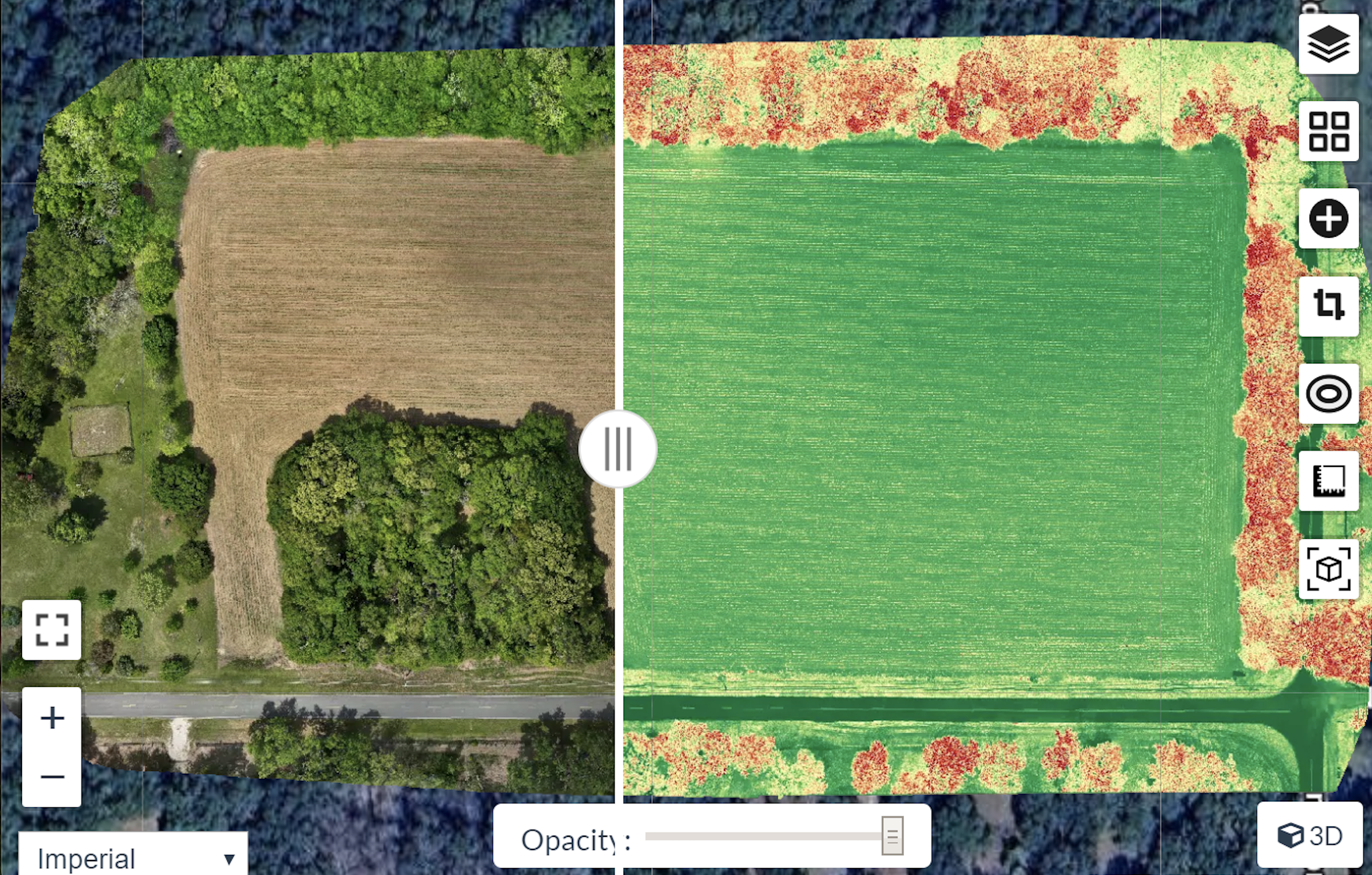
SKY TREK’s remote sensing drone capabilities capture high-resolution imagery to monitor crop health, detect pest infestations, identify drought stress, evaluate irrigation systems, and support precision agriculture with multispectral technology. Precision agriculture enables a "site-specific" approach to manage individual pockets of land according to their unique needs.

SKY TREK side-by-side comparison of field using aerial imagery to measure plant health. Our processed multi-spectral mapping pinpoints specific areas of crops needing more water, fertilizer, or pest control before the damage is visible to the naked eye.

Key Benefits:

- Improved Efficiency: Reduces   waste  by applying inputs in precise amounts and locations

- Higher Yields: Optimizes growing conditions for better, more consistent plant health.

- Cost Savings: Lowers expenses for fertilizer, fuel,and pesticides.